Navigating public transportation in a foreign country can transform your travel experience from stressful to seamless. Whether you’re stepping onto the Tokyo Metro for the first time or deciphering the colour-coded lines of Barcelona’s TMB system, understanding how international transit networks operate is essential for modern travellers. The difference between confidently exploring a new city and feeling overwhelmed often comes down to preparation and knowing which digital tools can guide you through unfamiliar transport infrastructure.
Global public transportation systems have evolved into sophisticated networks that move billions of passengers annually. From contactless payment integration to real-time service updates accessible through smartphone applications, the technological advancement of transit systems has made international travel more accessible than ever before. However, with this complexity comes the need for travellers to understand the nuances of ticketing systems, wayfinding standards, and cultural expectations that vary dramatically across different regions.
Pre-journey research: digital tools and mobile applications for route planning
The foundation of successful navigation through foreign public transportation begins long before you board your first train or bus. Digital planning tools have revolutionised how travellers prepare for journeys, offering unprecedented access to route information, timetables, and real-time service alerts. According to recent transport technology surveys, approximately 78% of international travellers now rely on smartphone applications for navigation assistance, a dramatic increase from just 34% a decade ago.
Google maps transit layer and Real-Time service updates
Google Maps has integrated public transportation data for over 25,000 cities worldwide, making it the most comprehensive navigation tool available to international travellers. The transit layer displays routes, schedules, and walking directions with remarkable accuracy across most major metropolitan areas. When you activate the transit layer, you’ll see colour-coded lines representing different transport modes—trains, buses, trams, and ferries—overlaid on the standard map interface.
The platform’s real-time service update functionality proves particularly valuable during service disruptions. Transport authorities in cities like London, Singapore, and New York feed live data directly into Google’s systems, allowing you to see delays, cancellations, and alternative routing options within minutes of incidents occurring. This integration eliminates the guesswork that once plagued international travellers attempting to navigate unfamiliar systems during peak hours or unexpected service changes.
Citymapper integration across london, paris, and tokyo networks
Citymapper has established itself as the premium option for urban transit navigation, offering hyper-local expertise across more than 100 cities globally. The application’s strength lies in its crowdsourced data collection and algorithmic route optimisation, which considers factors beyond simple journey time. When planning a route through Paris, for instance, Citymapper calculates the optimal combination of Métro lines, RER trains, and bus services whilst accounting for walking distances between platforms, station accessibility features, and historical delay patterns on specific routes.
The application’s “Get Off Alert” feature has become indispensable for travellers navigating systems where station announcements may be in unfamiliar languages. By tracking your location via GPS, Citymapper provides vibration alerts as you approach your destination stop, reducing the anxiety associated with missing your station in cities like Tokyo, where Japanese announcements dominate the audio landscape.
Moovit Crowd-Sourced data for accurate arrival times
Moovit distinguishes itself through community-driven data collection, with over 1 billion users contributing real-time information about service conditions across 3,500 cities. This crowdsourced approach proves especially valuable in regions where official transport authorities provide limited digital infrastructure. In cities across Latin America, Southeast Asia, and Eastern Europe, Moovit often delivers more accurate arrival predictions than official sources, as local users report actual vehicle positions and service irregularities.
The platform’s integration with informal transit systems—including jeepneys in Manila, dolmuş services in Istanbul, and matatus in Nairobi—addresses a significant gap in traditional navigation applications. These quasi-formal transport options, which operate outside official regulatory frameworks, move millions of passengers daily yet rarely appear in conventional mapping services. Moovit’s community reporting system captures these services, providing travellers with comprehensive multi-modal journey planning capabilities.
Rome2rio Multi-Modal journey comparison features
Rome2rio excels at comparing journey options across
Rome2rio excels at comparing journey options across multiple transport modes, helping you visualise how planes, trains, buses, ferries, and even rideshares connect between two points. Rather than forcing you to research each mode separately, the platform aggregates timetables, estimated prices, and total travel times on a single results page. This makes it invaluable when you are evaluating whether a regional train, an overnight coach, or a budget airline is the most efficient way to reach your destination.
For public transportation abroad, Rome2rio is particularly useful at the planning stage of complex itineraries, such as cross-border trips in Europe or multi-city journeys in Southeast Asia. Once you have identified a preferred route, you can click through to operators to confirm live schedules and book directly. Think of Rome2rio as your big-picture strategist, while tools like Google Maps, Citymapper, and Moovit handle the fine-grained, day-of-travel navigation.
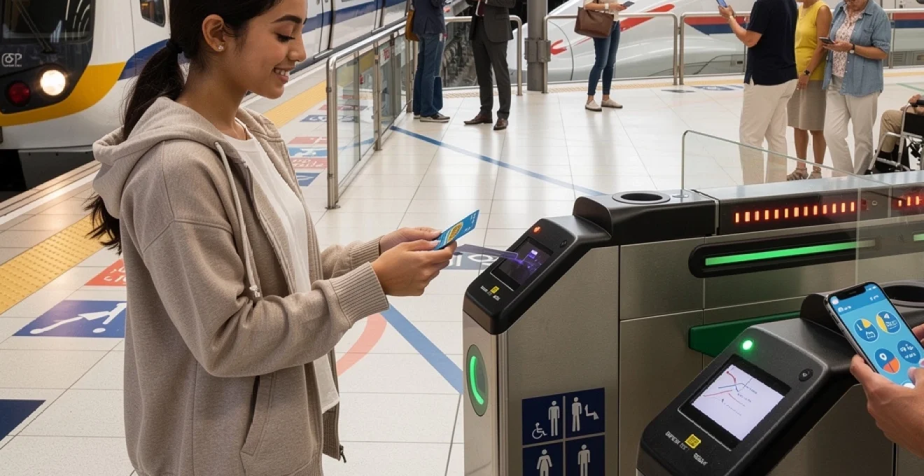
Ticketing systems and contactless payment methods worldwide
Understanding how to pay for public transportation abroad is just as important as knowing which route to take. Ticketing systems vary widely between cities and countries, from paper tickets and magnetic stripe cards to advanced contactless EMV and mobile wallets. Many networks now offer fare capping, daily or weekly passes, and integrated tickets across buses, trams, and metro services, which can significantly reduce your overall transport costs if you plan ahead.
Before you travel, it is worth researching whether your destination supports open-loop payments (using your bank card or phone directly at gates) or requires closed-loop smartcards that must be purchased and loaded with credit. Misunderstanding these systems can lead to unexpected fines or delays at barriers, particularly in cities with strict ticket validation rules. By familiarising yourself with the local ticketing ecosystem, you will move through stations more confidently and avoid queueing at vending machines at peak times.
Oyster card and contactless EMV in transport for london
London is a prime example of a city that has successfully transitioned from traditional smartcards to fully integrated contactless payments. The Oyster card, introduced in 2003, remains a popular option for residents and frequent visitors, allowing you to preload credit and enjoy daily and weekly capping across the Tube, buses, trams, DLR, London Overground, and most National Rail services within the city. For many travellers, however, tapping in and out with a contactless bank card or compatible smartphone is the simplest solution.
Transport for London (TfL) uses an EMV-based system that automatically calculates the best fare based on your journeys each day, up to a capped maximum. The key is consistency: you must use the same card or device for all taps, otherwise the system cannot join your journeys and will charge you more. If you are travelling in a group, avoid sharing one card; everyone needs their own payment method. This open-loop model has inspired similar systems in cities like Sydney, Singapore, and New York, making it increasingly intuitive to use public transportation abroad with the card already in your wallet.
Navigo pass zones and tarification in Île-de-France mobilités
Paris operates a different model through the Navigo pass, managed by Île-de-France Mobilités. Rather than pure pay-as-you-go contactless, Navigo focuses on zonal passes that cover specific geographic areas, from central Paris (Zone 1) out to the suburbs and major transport hubs like Charles de Gaulle Airport and Versailles. Weekly and monthly Navigo passes provide unlimited travel within the chosen zones, which can be extremely cost-effective if you are staying several days and taking multiple trips each day.
For short stays, visitors can now use Navigo Easy, a reloadable card designed for occasional users, or buy single-ride tickets and day passes that are loaded electronically rather than as paper tickets t+. When planning public transportation abroad in Paris, you should map the zones you expect to travel through—airport, hotel, central sights—and ensure your pass covers them. Misjudging the zone boundaries can result in incomplete validation, so always tap in and out where required, especially on RER lines that cross zone borders.
Suica and pasmo IC card technology in tokyo metro
Tokyo’s sprawling rail and metro ecosystem can appear intimidating at first glance, but IC cards such as Suica and Pasmo dramatically simplify the process. These rechargeable smartcards work across JR East lines, Tokyo Metro, Toei Subway, and most private railway and bus operators in the Greater Tokyo Area. You simply tap your card at entry and exit gates, with fares calculated based on distance and operator.
One advantage of Suica and Pasmo is their interoperability beyond Tokyo: they are accepted in many other Japanese regions, making them ideal for multi-city itineraries. In practice, using an IC card feels a bit like carrying a universal transit key; you do not need to worry about buying separate paper tickets for each leg. For travellers, this reduces friction when changing between networks and allows you to focus on reading directional signs rather than queueing at ticket machines after every transfer.
Mobile wallet integration: apple pay and google pay compatibility
As more cities adopt open-loop systems, mobile wallets such as Apple Pay and Google Pay have become powerful tools for navigating public transportation abroad. In London, New York, Hong Kong, and several European capitals, you can store your bank card or virtual transit card in your phone and simply tap your device at the gate. This not only speeds up boarding but also adds a layer of security, as your actual card number is tokenised and never shared with the transport authority.
However, compatibility is not yet universal. Some systems, like Suica in Japan, can be added to Apple Wallet but may not be fully supported on all Android devices or non-Japanese accounts. Others still require physical cards for tourists, especially in regions where smartphone penetration or contactless infrastructure is limited. Before departure, check whether your destination’s transport authority recognises your preferred mobile wallet, and always carry a backup physical card or some cash in case of technical issues or battery failure.
Decoding metro maps and wayfinding signage standards
Once you have your ticket sorted, the next challenge is understanding how to read metro maps and navigate within stations. At first glance, dense transit diagrams can resemble abstract art more than practical tools, especially in megacities like Tokyo or Beijing. Yet behind these graphics lies a set of design principles and standards developed over decades to make complex networks legible to both locals and visitors.
Learning to interpret these visual systems is like acquiring a new language: once you understand the grammar—line colours, station symbols, interchange icons—you can quickly decode maps anywhere in the world. This skill becomes a powerful asset when using public transportation abroad, enabling you to adapt even when apps fail or signage is only in the local language.
Harry beck’s topological design principles in underground systems
Many modern metro maps trace their lineage back to Harry Beck’s pioneering design for the London Underground in 1933. Instead of representing stations according to their exact geographic positions, Beck used a topological approach, treating the network like an electrical circuit diagram. Lines ran predominantly at 45- or 90-degree angles, distances between stations were normalised, and the focus shifted from geographic accuracy to navigational clarity.
This approach, now adopted by cities from Moscow to Mexico City, allows complex networks to fit neatly onto a small page or screen while remaining readable. For travellers, the key takeaway is that a short distance on the map does not always mean a short walk above ground. When planning public transportation abroad, use the map to understand the sequence of stations and interchange points, but rely on street maps or digital navigation for true distances between landmarks.
Colour-coded line identification in barcelona TMB and singapore MRT
Colour is one of the most intuitive tools used by transit authorities to help passengers differentiate lines at a glance. Barcelona’s TMB network assigns each metro line a distinct colour and number combination—such as L3 (green) or L5 (blue)—which appears consistently on maps, platform signs, and train fronts. Singapore’s MRT follows a similar pattern, with lines like the North South Line in red and the Downtown Line in blue, supplemented by clear alphanumeric station codes.
When you are navigating public transportation abroad, memorising the colour and name of your main line can often be easier than recalling its exact number or terminus. Think of it like following a coloured thread through a maze: as long as you stay on that colour and watch for the correct direction of travel, you are unlikely to get lost. This simple visual strategy is especially helpful in crowded stations where announcements may be hard to hear.
Pictogram universality and ISO 7001 standardisation
Beyond colours and line names, transit systems rely heavily on pictograms—simple, often monochrome icons—to communicate essential information regardless of language. The ISO 7001 standard defines many of these symbols, including those for toilets, information desks, first aid, and accessibility features. You will notice that the wheelchair icon, escalator symbol, or emergency exit running figure looks almost identical in Dubai, Berlin, and São Paulo.
For travellers, recognising this shared visual vocabulary can make navigating public transportation abroad far less stressful. When in doubt, follow the icons: a train symbol usually indicates mainline platforms, a circled M denotes metro, and an airplane icon points towards airport connections. Pictograms act as a universal backup when your translation app fails or local signage uses a non-Latin script that you cannot quickly decipher.
Language barriers and translation technology solutions
Language differences are one of the biggest psychological hurdles for travellers considering public transportation abroad, particularly in regions where English is not widely used on signage or announcements. Yet modern translation technologies have reduced this barrier dramatically. With the right tools, you can interpret station names, read service disruption notices, and even understand basic safety messages in real time.
Rather than seeing language barriers as a reason to avoid local transit, you can treat them as part of the cultural experience. A combination of apps, offline resources, and a few memorised phrases will usually be enough to get you from the airport to your accommodation and around major sights with confidence.
Google translate camera mode for signage and timetables
One of the most practical features in Google Translate for public transportation abroad is the camera mode, which overlays translations directly onto signs, maps, and printed timetables. By pointing your smartphone at a notice board or ticket machine, you can instantly see key words like “delay”, “platform”, or “replacement bus” in your own language. This is particularly helpful in countries that use scripts such as Cyrillic, Kanji, or Arabic, where sounding out letters may not be intuitive.
To maximise reliability, download the relevant language packs before you travel so that camera translations can work offline, for example in underground stations with no signal. While machine translations are not perfect, they are often accurate enough to convey the essentials—such as which line is closed or whether a particular train is express or local. Think of the app as your pocket interpreter that helps you make sense of fast-moving travel information.
Phonetic pronunciation guides for station announcements in mandarin and arabic
In some cities, the challenge is less about reading signs and more about recognising spoken station names. Systems in Beijing, Shanghai, Dubai, and Cairo may display Latin transliterations on screens, but announcements are often delivered primarily in Mandarin or Arabic. To bridge this gap, it is useful to carry a phonetic list of key stations, written in a way that reflects how they sound rather than how they are spelled.
For example, if you know that your stop in Beijing is written as 东直门 (Dongzhimen), practice saying it aloud a few times and note a simple phonetic cue in your notes. This makes it easier to understand when it is announced and to ask staff or fellow passengers for help. When navigating public transportation abroad in non-Latin-script countries, treating station names like vocabulary words in a language class can significantly boost your confidence.
Offline translation apps for underground networks without connectivity
Many metro systems still lack reliable mobile data coverage in tunnels, meaning you cannot always depend on online translation tools. In these situations, offline-capable apps such as Google Translate, Microsoft Translator, or DeepL (for pre-saved phrases) become essential. By downloading offline language packs and storing common travel phrases, you ensure that you can look up words like “exit”, “transfer”, or “ticket office” even when your phone has no signal.
It is also wise to keep a small set of screenshots on your device: a map of the network, your hotel address in the local language, and any key transfer stations highlighted. Think of these as analogue backups in digital form, ready to show to a station attendant or fellow passenger if you need directions. Combining offline translation with visual aids creates a safety net that makes public transportation abroad feel far more manageable.
Regional transit etiquette and cultural norms
Every public transportation system operates within a distinct cultural context, and what is considered polite or normal in one country may be frowned upon in another. Understanding local etiquette is not only a matter of courtesy; it can also affect your safety and comfort. Observing how locals behave on platforms and inside vehicles provides valuable clues, but a bit of prior knowledge will help you avoid common missteps.
From priority seating customs to queueing behaviour and mobile phone usage, paying attention to these soft rules can make you feel less like an outsider. In some ways, learning transit etiquette is like learning table manners in a new culture: the basics are universal, but the details vary, and locals appreciate it when you make an effort to adapt.
Priority seating protocols on deutsche bahn and JR east services
On both German Deutsche Bahn services and Japan’s JR East trains, priority seating is clearly marked for elderly passengers, people with disabilities, pregnant women, and travellers with young children. While you are not legally prohibited from using these seats when they are empty, social norms strongly encourage you to stand or move if someone in need boards. In Japan especially, remaining seated in a priority space when an older passenger is standing nearby can be seen as disrespectful.
When using public transportation abroad, a simple rule is to treat priority areas as “conditional”: you may sit there when trains are quiet, but stay alert and be ready to offer your seat immediately. In Germany, conductors and fellow passengers are usually direct but polite if someone forgets this courtesy; in Japan, disapproval is more likely to be expressed through silence and body language. Reading these unspoken cues is part of integrating smoothly into local transit culture.
Queue formation standards at bus rapid transit stations in bogotá TransMilenio
Bogotá’s TransMilenio Bus Rapid Transit (BRT) system is famous not just for its dedicated bus lanes but also for its structured boarding process. At many stations, passengers form orderly queues along marked lines on the platform, aligning with the bus doors indicated on the ground. This system helps maintain flow during peak hours and reduces pushing or crowding as buses arrive.
If you are unfamiliar with such protocols, it can be tempting to stand wherever there is space, but doing so may inadvertently disrupt the local boarding rhythm. When navigating public transportation abroad in BRT-heavy cities like Bogotá, Curitiba, or Guangzhou, look for floor markings and observe where commuters line up before taking your place. Respecting established queues is both practical and a sign of respect for the daily routines of local riders.
Mobile phone usage restrictions on shinkansen quiet cars
Japan’s Shinkansen bullet trains illustrate how cultural expectations around noise differ between regions. Many services designate “quiet cars” or have strict norms about phone usage, with passengers expected to switch their devices to silent mode and avoid voice calls within the carriage. If you must take a call, the polite practice is to move to the vestibule area between cars, where conversations are less likely to disturb others.
Similar quiet zones exist on some European long-distance trains, including routes operated by Deutsche Bahn and ÖBB. When using public transportation abroad, check carriage signage for icons indicating quiet areas or restrictions on phone use and loud music. Treat these spaces like shared libraries or co-working areas: soft conversation is acceptable, but prolonged loud calls or media without headphones will attract disapproval.
Safety protocols and emergency procedures across international networks
Safety is a critical consideration when using any form of public transportation abroad, and major transit authorities invest heavily in infrastructure and procedures to protect passengers. From platform edge doors and CCTV coverage to emergency intercoms and well-marked evacuation routes, these systems are designed to handle incidents ranging from minor disruptions to serious emergencies. However, their effectiveness depends in part on passengers knowing how to use them.
By familiarising yourself with basic safety features in stations and vehicles, you gain valuable peace of mind and the ability to respond calmly if something goes wrong. Think of it as the transit equivalent of learning the fire exits in a hotel: you hope never to need the information, but it is reassuring to have it.
Emergency intercoms and platform edge doors in dubai metro
Dubai Metro is one of the world’s most modern automated rail systems, and its design highlights a proactive approach to passenger safety. Many stations feature full-height platform screen doors that align with train doors, preventing accidental falls onto the tracks and helping to control climate within the station. These doors only open when a train is correctly berthed, which also reduces the risk of people or objects entering the track area.
Emergency intercoms are positioned along platforms and inside carriages, typically marked with bright colours and clear icons. If you experience harassment, a medical issue, or observe unsafe behaviour, pressing the intercom connects you directly to control staff who can dispatch assistance at the next station. When navigating public transportation abroad in high-tech systems like Dubai’s, it is worth noting the location of these devices as you board—just as you might mentally note where the emergency exits are on an aircraft.
Pickpocketing hotspots on paris métro lines 1 and 4
While serious violent crime on public transportation abroad is relatively rare, petty theft remains a concern in many tourist-heavy cities. In Paris, for example, Métro lines 1 and 4, which serve major attractions and busy transfer points, are known hotspots for pickpockets. Crowded carriages, especially near doors and during rush hours, provide ideal conditions for thieves to operate unnoticed.
Simple precautions can dramatically reduce your risk. Keep bags closed and in front of you, avoid storing valuables in back pockets, and be especially wary when distracted by maps or your phone. If someone creates an unusual commotion—dropping coins, pushing aggressively, or blocking doors—it may be a deliberate tactic to divert attention while an accomplice targets bags. Maintaining a calm, alert presence allows you to enjoy the efficiency of systems like the Paris Métro without unnecessary anxiety.
Accessibility features: wheelchair ramps and audio announcements compliance
Accessibility standards have improved significantly across many transit networks over the past two decades, making public transportation abroad more viable for travellers with mobility, visual, or hearing impairments. Features such as level boarding, deployable ramps, tactile paving, and lifts from street to platform are now mandated in newer systems and increasingly retrofitted in older ones. For instance, cities like Singapore and Vancouver offer near-universal step-free access on their metro lines.
Audio and visual announcements are another critical aspect of inclusive design. Modern trains typically display the next stop on LED screens while simultaneously announcing it over the loudspeaker, complying with accessibility regulations in regions such as the EU and North America. If you rely on these features, consult the accessibility section of the local transit authority’s website before you travel; many provide detailed station-by-station information on lifts, ramps, and assisted boarding services. Planning around these resources ensures that public transportation abroad remains not just efficient, but truly accessible for all travellers.